WAVE FORECAST PROVIDED BY THE
During the 39th
International Aegean Sailing Rally (12-22 July 2002) organized by the Hellenic
Offshore Racing Club (HORC), the Ocean Physics and Modeling (OPAM) Group of the
University of Athens (http://www.oc.phys.uoa.gr) will provide detailed 3-hr wave forecasts for
the areas where the regatta will take place. In that way, for the first time
this year, both weather forecasts, provided by the National Observatory of Athens, and wave forecasts (significant wave height and
direction) will be available to the participating sailing teams. It is believed
that this combined information will play an important role in the safety of the
regatta. It will also allow participating teams to better design their sailing
strategy.
The wave forecasts will be
available directly from the dedicated to the rally website of HORC (http://www.aegeanrally.gr) and will cover
the geographical areas of the

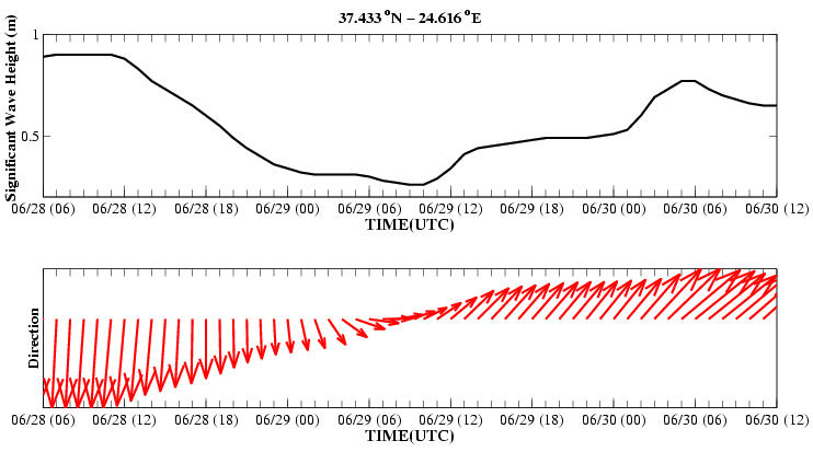
Further to that, at
pre-selected points, along each of the four legs of the rally, the significant
wave height and direction for the forecast period will be provided in the form
of time series plots.
Additional wave forecasts
for the broader area of the
The wave forecasts are
provided through the Integrated Wave Forecast System ‘TRITON’ developed by the
OPAM Group of the
In all wave forecast models,
with the exception of the Global Ocean one, the wind field used to force the
models is taken from the Atmospheric Weather Prediction System ‘SKIRON’
developed by the Atmospheric Modeling and Weather Forecasting Group of the
University of Athens (http://forecast.uoa.gr).
Note : Because of the complex form of the waves in an area and the co-existence of waves with different heights, the internationally accepted and used term for the description of the wave height is the so-called Significant Wave Height which is the average height of the highest third of the waves.